Drones and mobile technologies
Innovative solutions in agriculture, forestry and geodesy
Unmanned Aerial Systems – commonly known as drones – and mobile technologies are becoming more and more common in many sectors of the economy as they guarantee the fastest and most accurate collection of detailed data. Drones effectively support the work of many industries, mainly due to automation of activities and processes. So far, they have gained the most supporters among farmers, foresters and surveyors.
BZB UAS: drones with intuitive control systems
Unmanned Aerial Vehicles offered by BZB UAS are used by specialists in agriculture, forestry and civil engineering to more effectively, quickly and safely carry out tasks such as collecting data on damages caused by wild animals, inventory of urban areas or planning harvest dates. Minimum set of tools used in an effective way achieves stated objectives of enterprises and individuals in terms of land development, its monitoring as well as coordination and management.
One of the key elements of the BZB system is a mobile application for mission planning, that is simple and intuitive. This was accomplished by working with specialists from HeroDOT. The most dangerous human factor has been reduced to a minimum. Missions are autonomous and automated – the user has no direct involvement in the procedure of flight, take-off or landing. The flight controlling application is simple and intuitive enough for everyone to handle the drone on their own and use modern solutions in their company or institution. How do drones support different sectors of the economy?
1. Drones and mobile technologies in precise agriculture

BZB UAS systems are designed to effectively help farmers with their biggest problem, which is collecting detailed knowledge about their crops in real time. Drones offered by BZB UAS allow you to move the decision-making basis from guesswork or statistical assumptions to facts and precise data. The strength of BZB UAS technology is quality and the speed of providing information.
Unmanned Aerial Systems offered by us significantly increase efficiency of the farm. Thanks to the application of the NDVI system (Normalized Difference Vegetation Index) creates new ways to minimize expenses on fertilizer and maximize yields. For this purpose detailed information collected by drones on soil moisture, fertilizer and microelements concentration, development of plants, occurence of diseases, pests and weeds, and crop maturity are used.
System, part of which is the application created by HeroDot, allows users to generate a report about the field within one day. Thanks to cameras and sensors, drones are able to collect all parameters that are crucial for precision agriculture. In addition, we can use them to perform direct actions on the field such as spraying or scaring away wildlife.
The system was created in such a way to be based on automation and artificial intelligence. Using this application, we remotely control the work performed by drones, without having to move from one place to another. Measurements carried out by the UAVs are not only precise but also immediately delivered to the customer, which significantly improves farmers response time to processes and damages.
It is especially important in the case of damages caused by wild animals, where the speed of response has the greatest impact on its effectiveness. Orthophotomaps prepared by BZB UAS systems will make it easier to work out where the damage occured and to plan the most effective remedial action. Moreover, these maps themselves are evidence of damage and can be included in the documentation to increase the chance of receiving compensation from the hunting club or insurance company.
First of all, Unmanned Aerial Systems offered by BZB UAS directly contribute to modernization of the appearance of farmers’ work. In the future drones will not only assist, but also replace humans, and as machines they are able to do many things faster and more accurately. Thanks to BZB UAS systems, farmers can make more use of their experience and knowledge, to supervise and monitor farms with the help of working digital systems. This investment brings long-term benefits in terms of minimizing costs and maximizing quantity and quality of harvested crops.
2. Drones and mobile technologies in forestry
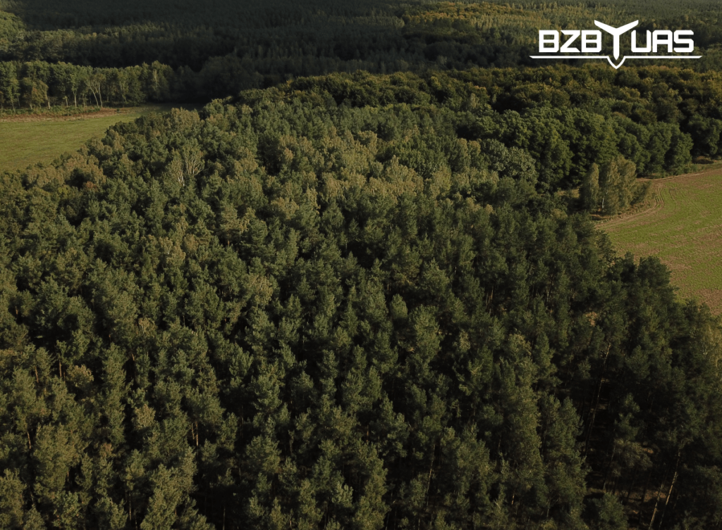
Unmanned Aerial Systems offered by BZB UAS allow to perform an inventory of a forest with significantly shorter time consumption than required by other, classic methods. You could say that this system works like the equivalent of Google Maps for forests. It definitely makes it easier to explore the area and gain knowledge about the structure of the forest. Maps, that are created by the BZB UAS application, are made by overlying hundreds of photos taken from the air
In addition, unmanned aerial vehicles give the ability to inspect trees by estimating their height and crown diameter. Due to its innovative system, drones offered by BZB UAS only need 5 meters to take-off. It makes it easy for them to reach even the most difficult-to-reach places.
Unmanned Aerial Vehicles also contribute to a better health of the forest by enabling regular defoliation testing, controlling the impact of pollution or checking the condition of the crown. One of the most interesting and important tools is the NIR index, which specifically shows which trees are sick or infested with pests, making the work of foresters much easier. Drones also help pinpointing damage after wildfires and storms, by showing a specific area and displaying the number of fallen trees.
Most importantly the Unmanned Aerial Systems offered by BZB UAS have a positive impact on the foresters’ work. By collecting accurate information about the forest they are able to precisely combat emerging problems as well as resolve disputes. Thanks to the BZB UAS systems, foresters can use their experience and knowledge in a broader perspective than before to supervise and monitor forests as well as decide on their management. This investment, as in the case of agriculture, brings long-term benefits in the form of minimizing costs associated with maintaining the forest.
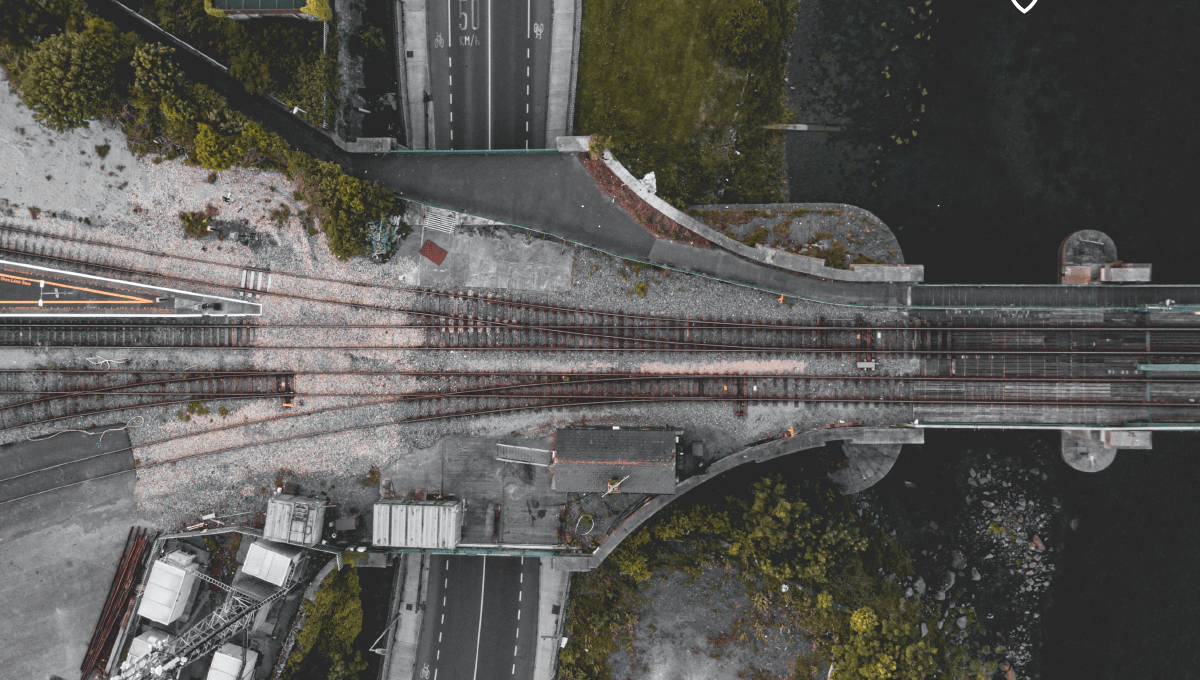
3. Drones and mobile technologies in civil engineering
a) 3D Maps and photogrammetry
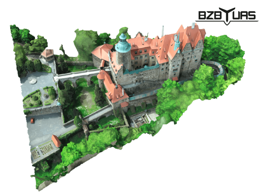
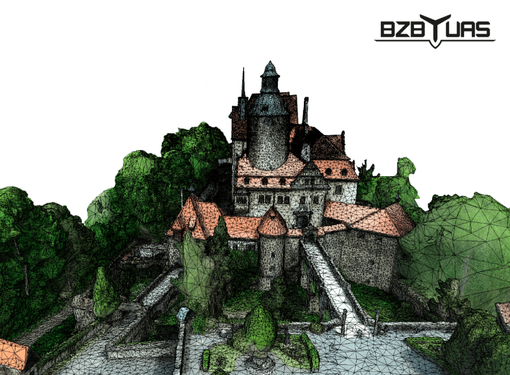
Systems offered by BZB UAS allow for a visualization of the terrain in the form of a 3D map by performing a photogrammetric flight. They also use remote sensing methods to translate land infrastructure into a digital model. Digital orthophotomap has all the features of a real geodetic map, and its accuracy is so great that you could spot a coin laying on the ground.
BZB UAS drones allow you to accurately estimate the distance and area of a given area as well as determine the height or decline of the terrain. Additionally with the help of the application, it is possible to visualize potential investments, show how specific buildings would look like in the investment area and how they would fit together as a whole. It is especially important for urban space architects, who want to maintain subdued, pleasant aesthetics in places located close to each other.
b) Expertise on the building condition, roof inspection, photovoltaics
Precise analysis of the condition of buildings, their roofs and gutters is possible through photos collected by drones. The camera accurately shows all the risks associated with damages, cracks or deficiencies in buildings. Reaching even the most difficult to reach nooks and crannies of gutters or cornices is not a problem with the systems offered by BZB UAS.
These possibilities offered by Unmanned Aerial Systems are especially important when inspecting the roof, when it is necessary to calculate its area, the number of tiles needed or the total cost of materials needed for this investment. It is also a perfect tool for identifying damaged roof tiles and then replacing them. Unmanned aerial vehicles make it easier to identify flaws related to the connection and patency of the gutters, as well as to detect cracks, deformations and corrosion.
The last specialized case in which the systems offered by BZB UAS can help is profitability of installing photovoltaics. Thanks to drones there is a possibility to analyze the surface and the tilt angle of the roof. In this way it is possible to estimate the efficiency of solar panels and the expected return on investment over time. Recently, thanks to the EU funds, investments in solar panels have become very popular and accurate financial analysis is crucial to convince potential customers to invest in solar panels.
c) Safety
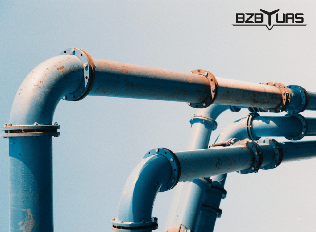
Thanks to the systems offered by BZB UAS there is a possibility of increased control over your business security. Unmanned Aerial Vehicles can perform inspections of various installations, such as wind turbines or gas pipes, have a look at usually inaccessible places and thus detect abnormalities. For example, BZB UAS started cooperating with PKN ORLEN. With the help of Unmanned Aerial Systems the company is able to specify where illegal attempts to interfere with the pipeline are taking place. Thanks to drones we are able to check whether anyone is connecting to the pipeline without permission, which translates directly into minimizing financial losses.
TAKE ADVANTAGE OF BZB UAS SYSTEMS
Unmanned Aerial Systems must be simple, safe and intuitive. BZB UAS achieves it with modern systems that are used in their Unmanned Aerial Vehicles and an app created in cooperation with HeroDOT – this combination guarantees highest quality and easy to use drones for non-technical users. BZB UAS offers a comprehensive service that includes not only the sale of innovative drones but also training on how to use them. As authorized instructors with their own training center, they are able to pass the knowledge to any group of people that needs it.
Currently, UAS can be used for inventory of crops, forests, buildings and investments. Systems offered by BZB UAS also contribute to maximizing the quantity and quality of crops, fighting pests, analyzing soil moisture and creating spatial maps. Offered solutions are environmentally friendly and perform operations without the airport infrastructure and allow for quick acquisition of high-accuracy data
All these changes are directly profitable for companies and farms as they lead to increased efficiency and cost optimization in comparison to alternative solutions. Take advantage of our offer and order flight with an unmanned aerial vehicle.

